As an integral part of the National Annexes for the application of Eurocode 1, Parts 1-3, 1-4 and 1-5, it is necessary to develop snow load, wind and temperature maps, and for the application of Eurocode 8, part 1, the map of earthquake areas in Bosnia and Herzegovina.
Development of the interactive maps for National Annexes:
- BAS EN 1991-1-3/NA:2018,
- BAS EN 1991-1-4/NA:2018,
- BAS EN 1991-1-5/NA:2017 and
- BAS EN 1998-1/NA:2018
was financially assisted by the Czech Development Agency (Česká rozvojová agentura – ČRA), and the Czech Office for Standardization, Metrology and Testing (Úřad pro technickou normalizaci, metrologii a státní zkušebnictví – ÚNMZ) as part of the project “Support to the Institute for Standardization of Bosnia and Herzegovina in the field of application of Eurocodes”.
Interactive maps
Ground snow load map of B&H
BAS EN 1991-1-3/NA:2018
Wind load map of B&H
BAS EN 1991-1-4/NA:2018
Maximum and minimum air temperatures map of B&H
BAS EN 1991-1-5/NA:2017
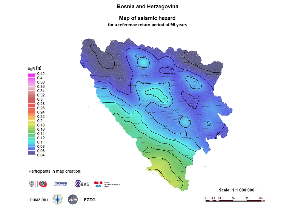
Seismic zone maps and reference ground accelerations therein of B&H
BAS EN 1998-1/NA:2018
Note: To read the data required for the design, enter the coordinates of the object location or click on the interactive map for the location of the object (you can move or zoom the map).
Maps from original standardization documents
Given the great interest of the construction industry for the contents of the maps published in National Annexes, the review of the maps have been available for all stakeholders by the Institute for Standardization of Bosnia and Herzegovina.
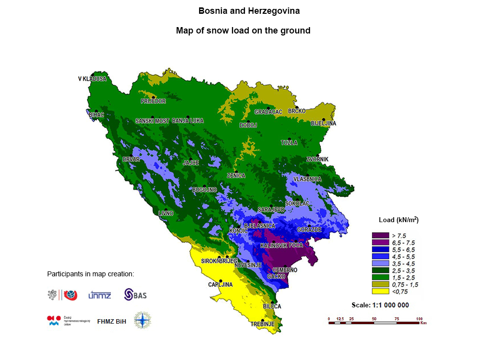
GROUND SNOW LOAD MAP OF B&H
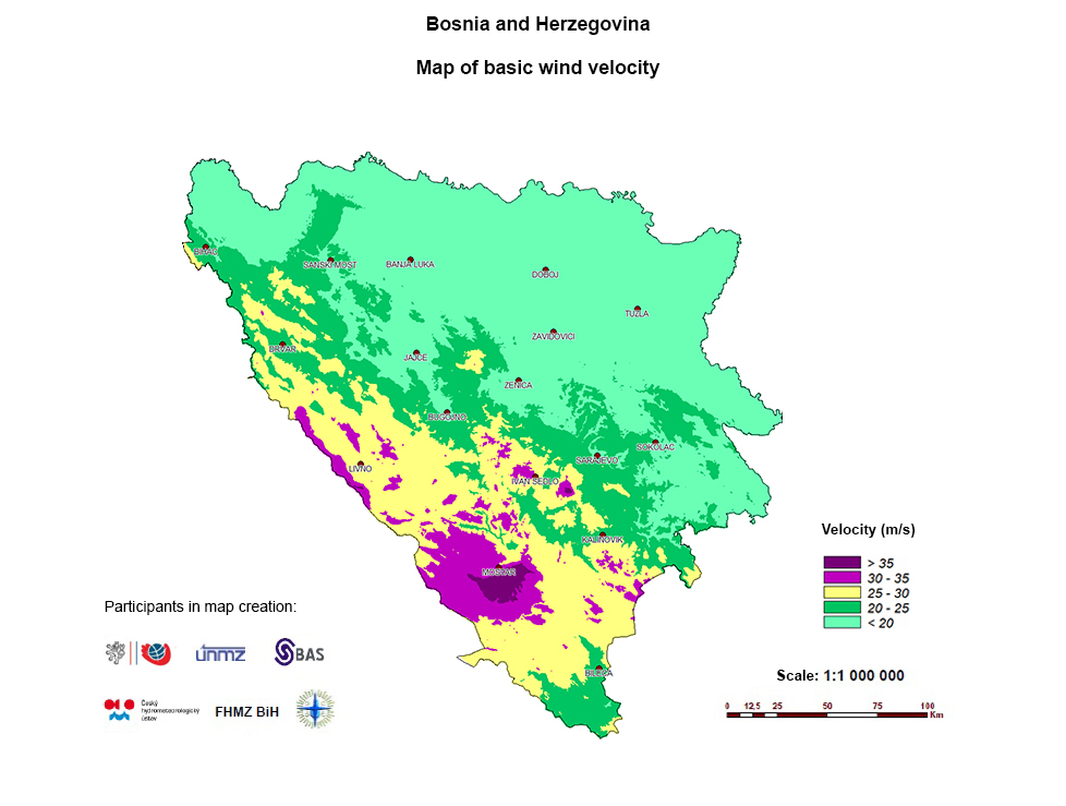
WIND LOAD MAP OF B&H

LOWEST AIR TEMPERATURE MAP IN BIH
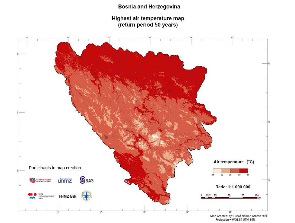
HIGHEST AIR TEMPERATURE MAP IN BIH
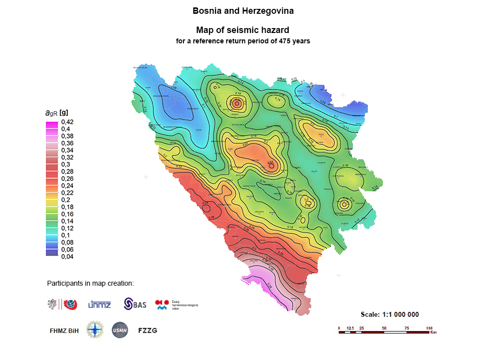
Map of seismic hazard – return period of 475 years